|
CHINA DRONE TECHNOLOGY
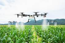
Drones, or Unmanned
Aerial Vehicles (UAVs), are aircraft without a human pilot on board,
controlled remotely or autonomously via onboard software and sensors.
Drone technology integrates aerospace, robotics, and sensors, ranging
from small consumer quadcopters to, industrial, and military systems.
They are used for photography, surveillance, agriculture, and delivery.
Key Aspects of Drone Technology
-
Components & Types:
Drones typically consist of a frame, motors, propellers, batteries,
controllers, and sensors (GPS, cameras, LiDAR). Main types include
rotor (multi-rotor, quadcopters), fixed-wing, and hybrid vertical
take-off and landing (VTOL).
-
Control Systems:
Operated via radio controllers (manual) or autonomous systems using
GPS and Artificial Intelligence (AI) for pre-programmed flight paths
and, object recognition.
-
Classifications:
Drones are classified by weight, ranging from Class I (small, 0–150
kg) to Class III (large, over 600 kg).
-
Applications:
-
Aerial
Photography & Videography:
High-resolution imaging for media.
-
Agriculture:
Precision mapping, crop spraying, and health monitoring.
-
Infrastructure & Inspection:
Monitoring bridges, pipelines, and power lines.
-
Defense & Security:
Surveillance, reconnaissance, and loitering munitions.
-
Logistics:
Last-mile package and medical deliveries.
CURRENT
STATUS OF DRONE TECHNOLOGY IN CHINA
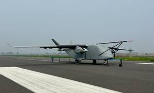
China is a global
leader in drone technology, with a massive industry producing over 1.2
million units annually and an estimated market value of over $ 600
billion by 2035. Key advancements include AI-controlled drone swarms,
1-ton cargo delivery drones, and advanced military capabilities like
stealthy long-endurance ISR aircraft and hypersonic-launched
surveillance units.
Key Areas of
Advancement and Status:
-
Military & Defense:
China is rapidly advancing in autonomous systems and swarm
intelligence, recently demonstrating a 200-drone, single-operator
swarm. The military uses advanced, long-endurance, stealthy drones
for reconnaissance (ISR) and surveillance. New developments include
hypersonic-capable drones launched from artillery shells.
-
Commercial & Civil Market:
China dominates the global drone market, leveraging manufacturing
expertise to produce high-quality, low-cost consumer and industrial
drones. The industry is shifting toward logistics, featuring drones
with up to 1-ton cargo capacity and a 1,000-mile range.
-
Regulatory & Infrastructure:
To support the "low-altitude economy," China has implemented the
Unmanned Operation Management System (UOM) to regulate over 1.2
million registered drones and 270,000 licensed pilots. High-speed 5G
and 5G-A networks are deployed to support drone navigation and
communication.
-
Counter-Drone Technology:
The country is developing advanced anti-drone technology, including
50-kilowatt laser weapons integrated into mobile, 8x8,
eight-wheeled, 8-wheel-drive trucks.
China's drone industry
continues to grow, with a projected compound annual growth rate (CAGR)
of 15.11% from 2025 to 2030, driven by both domestic use and exports.
WHY CHINA IS
THE GLOBAL LEADER IN DRONE TECHNOLOGY AND DEVELOPMENT
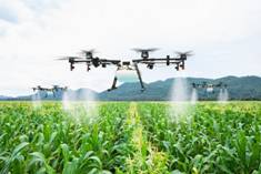
China leads the global
drone market, producing over 70% of the world's commercial drones,
driven by a mature, integrated supply chain in Shenzhen, intense
innovation from companies like DJI, and strong government backing for
the "low-altitude economy". Their success combines rapid, cost-effective
manufacturing, high-volume production, and widespread domestic adoption
in agriculture, logistics, and security.
-
Manufacturing Ecosystem &
Supply Chain:
Shenzhen acts as a global drone hub with a dense, specialized
manufacturing base, making it easy to source components, which
drives down costs.
-
Dominant Market Share &
Innovation: DJI
holds over 70% of the consumer market, driven by rapid R&D that
keeps them ahead in technology. Chinese firms are fast innovators in
flight controllers, motors, and FPV systems.
-
Government Support & "Made in
China 2025": The
government actively promotes the industry through policies that
foster civil-military fusion and investment in UAV (Unmanned Aerial
Vehicle) technology.
-
Cost-Effectiveness:
Chinese firms focus on providing "good enough" technology, offering
highly capable yet cost-effective drones, which appeals to global
markets.
-
Widespread Domestic
Application:
Drones are widely used within China for agricultural spraying, power
line inspection, and logistical delivery, providing a huge testing
ground for refining technology.
-
High-Volume Battery Production:
China controls a significant portion of the global lithium-ion
battery supply chain, crucial for drone power systems.
-
Government Leadership:
Most important factor for China’s success is the government’s
ability to develop, plan and execute long term visions successfully
on time and on budget. Government policies and expenditures are
focussed on benefiting the country and its people rather than
special interests.
-
Massive Scientific and
Engineering Talent.
China produces more STEM students each year than the
US and G7 countries combined. Most of the world’s top STEM
universities and research institutions are in China.
FUTURE
DIRECTIONS AND DEVELOPMENT

China's drone
technology is advancing rapidly, aiming for total industry dominance by
2035 with a projected $ 600 billion market. Future development focuses
on AI-enabled autonomous swarms, satellite-independent navigation
(GPS-free), long-endurance "motherships," and, crucially, integrating
civilian commercial technology into military "wingman" and,
specifically, low-cost expendable, combat-ready drones.
-
AI-Driven Autonomy and Swarming:
China is investing heavily in Artificial Intelligence (AI) to create
swarms of drones capable of collaborative, autonomous
decision-making in combat, reducing reliance on human operators.
-
Satellite-Independent Navigation:
By 2028, China aims to implement satellite-independent navigation in
drones, missiles, and submarines, creating a,, "silent edge" that is
not vulnerable to GPS jamming.
-
Civil-Military
Fusion: The line between
civilian and military drones is blurring. China is leveraging its
massive, leading commercial FPV (First Person View) and consumer
drone industry (DJI, etc.) to produce cheap, expendable, and, highly
effective, tactical, combat-proven drones.
-
"Drone
Motherships" & Stealth:
Development is leaning towards high-altitude, long-endurance, "drone
motherships" capable of deploying smaller, specialized drones. New,
air-superiority, stealth drones are also being developed for
high-manoeuvrability aerial, combat.
-
Anti-Access/Area Denial (A2/AD) Capabilities:
Drones are increasingly designed with heavy, weapon-carrying,
capacities to function as strategic, offensive weapons in, scenarios
like, a, Taiwan, strait conflict.
-
Supply Chain
Dominance: China
controls, the majority, of, the, global, drone, supply, chain,
including, lithium-ion, batteries, for, power, systems, and,
critical, components, (controllers, motors), further cementing, its,
position as, the dominant player, in, FPV, drone production.
Key Sectors
of Growth
-
Logistics & Agriculture:
Drones are heavily utilized forlast-mile delivery and, agricultural,
monitoring, across China.
-
Military Reconnaissance &
Strike:
Unmanned, combat aerial vehicles (UCAVs) are, being, deployed
globally and are a focus for, future PLA operations.
By 2030, the Chinese
military expects to field, a range of "algorithmic warfare," and
"network-centric warfare," capabilities
DOMESTIC AND
GLOBAL MARKET SHARE
China dominates the
global drone industry, controlling nearly 90% of the commercial drone
market and over 80% of the consumer drone market as of 2026, with
DJI leading the
sector. Chinese manufacturers also dominate the supply chain, with major
market shares in components like batteries, while the domestic market
for drones is projected to reach over USD 600 billion by 2035.
Global Market
Share and Leadership
-
Dominance:
China holds a 70–90% share of the global commercial drone market and
over 80% of the consumer market.
-
Key Players:
DJI is the industry leader, while other firms like Autel Robotics
are also gaining market share.
-
Component Dominance:
China produces the majority of essential components, including
airframes, cameras, and batteries.
-
International Reach:
Chinese drones are used globally in various applications, including
public safety, with over 70% share in some U.S. sectors.
Domestic
Market in China
-
Market Size:
The China drone market was valued at over USD 9.7 billion in 2024,
projected to grow to over USD 600 billion by 2035. In 2024, there
were over 1.875 million registered drones in China
-
Low-Altitude Economy:
The Chinese government is heavily promoting the "low-altitude
economy," which includes drone logistics for cargo delivery and,
eVTOL (electric vertical take-off and landing) services,
particularly in cities like Shenzhen. The domestic "low-altitude
economy" was more than 1.5 trillion RMB in 2025. As a strategic,
high-growth sector, it encompasses industries below 1,000 meters,
including urban passenger transport, emergency services, and
agricultural applications
-
Industry Scale:
As of 2025, there are over 3.2 million registered drone-related
enterprises and over 1.2 million active drones in China.
-
Application Areas:
Rapid growth is fuelled by agriculture, logistics, and, notably,
advanced
intelligent clustering
techniques used in light shows.
-
Regulations & Infrastructure:
The industry is supported by robust government policies, including
the 15th Five-Year Plan (2026–2030), which focuses on developing
drone infrastructure and airworthiness-grade products
KEY
REASONS FOR CHINA'S DRONE LEADERSHIP INCLUDE:
-
Integrated Supply Chain:
The Pearl River Delta region provides an unparalleled ecosystem
where manufacturers can source essential components—LiDAR,
batteries, and cameras—within a small radius.
-
Manufacturing Powerhouse:
Decades of experience in electronics, particularly from the
smartphone industry, were applied to drones, offering high quality
at low costs.
-
Government Support & Policy:
The Chinese government heavily invests in and prioritizes the
unmanned aerial vehicle (UAV) industry, driving "Made in China 2025"
initiatives and supporting "low-altitude economy" development.
-
Rapid Innovation & AI
Integration:
Chinese firms lead in AI-powered, autonomous flight systems, 5G
connectivity, and superior battery performance.
-
Domination of Key Components:
China produces the majority of crucial drone components, including
75% of global lithium-ion batteries, motors, and flight controllers.
-
Wide Application &
Infrastructure:
China has built extensive infrastructure for drone applications,
including large-scale testing zones and a robust regulatory
platform, fostering rapid deployment in agriculture, logistics, and
surveillance.
-
Government Leadership:
Most important factor for China’s success is the government’s
ability to develop, plan and execute long term visions successfully
on time and on budget. Government policies and expenditures are
focussed on benefiting the country and its people rather than
special interests.
-
Massive Scientific and
Engineering Talent.
China produces more STEM students each year than the
US and G7 countries combined. Most of the world’s top STEM
universities and research institutions are in China
LOW ATTITUDE
ECONOMY
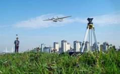 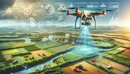
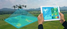
The industry is rapidly
shifting toward a "low-altitude economy," moving beyond simple
photography to integrated industrial services.
China's drone
technology is rapidly advancing toward a $500+ billion "low-altitude
economy" by 2035, driven by AI integration, autonomous, and swarm
capabilities for both commercial and military use. With over 70% of the
global market share and massive domestic investment, China is
transitioning from simple drone production to creating sophisticated,
AI-powered aerial networks in logistics, agriculture, and defense.
Key future
developments in China's drone sector include:
-
Low-Altitude Economy Boom:
The market is projected to reach 3.5 trillion yuan (~$500 billion)
by 2035, with drones heavily utilized in courier delivery, urban
logistics, agricultural spraying and inspection.
New technologies include hybrid-power cargo drones (e.g.,
Caihong-YH1000S)
for increased range and payload, and specialized AI-integrated
models for logistics, agricultural spraying, and city-wide parcel
delivery.
-
AI and Swarm Technology:
Future developments focus on AI-driven, fully autonomous drone
swarms for complex tasks, enhancing both consumer products and
military applications.
-
Military "Wingman" Drones:
China is accelerating the deployment of stealthy, "wingman" (loyal
wingman) drones designed to operate alongside manned aircraft, as
seen with new tailless configurations, reports the Global Times.
-
Urban Air Mobility (UAM) and
eVTOL:
Significant investment is being poured into manned and unmanned
passenger-carrying eVTOL (electric vertical take-off and landing)
aircraft, exemplified by EHang's
EH216-S operations.
-
"Good Enough" Cost Disruption:
China is targeting global dominance with low-cost, high-capability
models like the Feilong-300D, designed for long-range, versatile
missions, according to this article.
-
Regulatory Support:
The government is proactively rewriting airspace rules and setting
up civil aviation test zones to facilitate rapid commercial drone
deployment.
China is rapidly
advancing military drone applications, focusing on AI-driven swarms,
high-speed reconnaissance (e.g., WZ-8), and loitering munitions to
achieve asymmetric advantages, with over 1.26 million units by 2023
. Key uses include
swarm strikes, anti-tank warfare, and reconnaissance, aimed at
overcoming air defenses and conducting gray-zone tactics.
KEY
MILITARY APPLICATIONS OF CHINESE DRONES:
-
Drone Swarms:
China is developing and testing large-scale, AI-driven drone swarms
capable of autonomous, collaborative missions, including
surveillance and precision strikes, with systems capable of
launching 48 to 200 units.
-
Loitering
Munitions and Anti-Tank
Warfare: Chinese drones are engineered to neutralize armored
vehicles by targeting them from above, with capabilities for
attacking from 100 meters, achieving high precision.
-
High-Speed/High-Altitude Surveillance:
The WZ-8 supersonic reconnaissance drone is utilized for
high-altitude intelligence gathering, operating at altitudes of
100,000 feet.
-
Electronic
Warfare and Decoys:
Drones are used for jamming, deception, and simulating other
aircraft in contested regions like the South China Sea to test
defense responses.
-
Small/Micro
Drones: Development
includes mosquito-sized drones for clandestine surveillance and
tactical intelligence gathering.
-
Armed UCAVs:
The CH-9 and other combat drones are armed with air-to-air/anti-ship
missiles and bombs, enabling strikes in regional conflicts.
Drones are transforming
agriculture through precision, using advanced sensors and imaging to
enhance crop monitoring, soil analysis, and livestock management. Key
applications include automated spraying of fertilizers/pesticides,
high-resolution mapping for irrigation, early pest/disease detection,
and rapid herd tracking. These tools, as described by
Precision Ag Services,
optimize yields and reduce operational costs.
KEY
APPLICATIONS OF AGRICULTURAL DRONES:
-
Precision Spraying and Seeding:
Drones provide targeted application of pesticides, herbicides, and
fertilizers, which reduces chemical usage and prevents waste. They
can also be used for seeding, particularly in hard-to-reach areas.
-
Crop Health Monitoring:
Utilizing multispectral and thermal sensors, drones capture
high-resolution imagery to detect crop stress, disease, nutrient
deficiencies, and water issues (NDVI mapping) before they are
visible to the naked eye.
-
Irrigation and Soil Management:
Drones map soil moisture and topography, allowing for better water
management and the identification of areas needing better irrigation
or drainage.
-
Livestock Management:
Drones, especially those with thermal cameras, are used to monitor
herd health, track animal movement, and locate livestock in large or
difficult terrain.
-
Mapping and Surveying:
They create 3D maps and high-resolution images of fields, assisting
with land management and planning.
Benefits to
Farmers:
-
Increased Efficiency:
Rapid surveying and automated tasks save time and labor.
-
Cost Reduction:
Lowered use of pesticides, water, and fuel.
-
Higher Yields:
Early detection of problems allows for immediate, targeted
interventions.
-
Improved Safety:
Removes the need for personnel to access dangerous or difficult
terrain.
Drones, or Unmanned
Aerial Vehicles (UAVs), leverage remote sensing (cameras, LiDAR,
multispectral) for large-scale data collection and proximity sensing
(ultrasonic, LiDAR) for close-range navigation and object interaction.
Key applications include
precision agriculture,
infrastructure inspection,
environmental monitoring,
disaster management, and
automated 3D mapping.
REMOTE
SENSING APPLICATIONS (LONG/MID-RANGE DATA ACQUISITION)
Drones equipped with
sensors gather data from a distance, typically for mapping and
monitoring:
-
Agriculture:
Monitoring crop health, nutrient levels, and pest infestations using
multispectral imagery to optimize inputs.
-
Environmental
Monitoring: Tracking
deforestation, wildlife habitats, water quality, and volcanic gas
sampling.
-
Infrastructure
Inspection: Surveying
power lines, bridges, pipelines, and construction sites to detect
damage or monitor progress.
-
Mapping and
Surveying: Generating
high-resolution orthomosaics and 3D terrain models using
photogrammetry and LiDAR for urban planning and archaeology.
-
Disaster
Management: Assessing
damage after floods, earthquakes, or wildfires.
PROXIMITY
SENSING APPLICATIONS (CLOSE-RANGE/TACTICAL)
Drones use proximity
sensors (ultrasonic, laser/LiDAR) for real-time interaction with their
immediate environment:
-
Obstacle
Detection and Collision Avoidance:
Using LiDAR or ultrasonic sensors to navigate complex, tight, or
GPS-denied environments.
-
Close-Range
Inspection: Enabling
safe, close-up inspections of critical infrastructure, allowing for
very high-resolution imaging.
-
Aerial
Manipulation: Using
proximity sensors for precision placement or grabbing objects, which
is critical for aerial robotics and, in some cases, logistics.
-
Collision
Avoidance between UAVs:
Utilizing privacy-preserving protocols to allow drones to detect
mutual proximity and adjust paths to prevent accidents.
Common Sensor
Payloads
-
Remote:
RGB Cameras, Multispectral/Hyperspectral Cameras, LiDAR, Thermal
Cameras.
-
Proximity:
Ultrasonic Sensors, Short-range LiDAR, Time-of-Flight (ToF) cameras
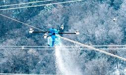
China is heavily
deploying drones and specialized de-icing robots to remove snow and ice
buildup on high-voltage power lines during severe winter conditions
This technology is
designed to prevent power outages caused by sagging or snapping lines,
especially in mountainous regions like Anhui, Hubei, and Sichuan, while
eliminating the need for hazardous manual maintenance.
KEY
APPLICATION METHODS
-
Airlifted De-Icing Robots:
Heavy-lift drones (e.g., DJI FlyCart 30) transport specialized
robots to the lines. The robot locks onto the live transmission
cable and moves along it, using mechanical rollers and cutters to
break and remove ice.
-
Mechanical Ice-Breaking Drones:
Drones are equipped with specialized, non-conductive, insulated rods
or "de-icing sticks." Operators fly the drones to directly strike
the power lines, causing the built-up ice to shatter and fall.
-
Dual-Mode De-Icing:
Some drones employ a combination of mechanical vibration and cutting
blades to remove ice, reportedly increasing efficiency by more than
60% compared to traditional methods.
Efficiency
and Safety Impact
-
Speed:
These methods can clear roughly 20 meters of iced-over wire in
approximately one minute.
-
Safety:
The technology replaces the need for workers to climb towers in
dangerous sub-zero temperatures and high winds.
-
Operation:
The robots are capable of working in temperatures as low as -30°C to
-70°C.
-
Smart Inspection:
Drones use LiDAR and AI to scan for ice buildup,,, with some units
capable of operating in low-visibility, foggy conditions.
These measures have
been crucial in preventing major power outages during recent, severe
winter cold waves, such as those in Hubei and Anhui provinces in early
2026
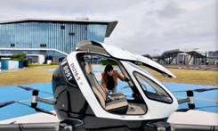
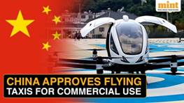
China is rapidly
developing a comprehensive "low-altitude economy" (<1,000 meters) for
drone transportation, focusing on urban food/medical delivery, rural
logistics, and electric vertical take-off and landing (eVTOL) "flying
taxis". Major firms like Meituan, JD.com, and SF Express use autonomous
drones for rapid, cost-effective, and last-mile delivery, particularly
in cities like Shenzhen, where over 200 routes exist.
KEY
APPLICATIONS AND DEVELOPMENTS:
-
Urban & Rural Delivery:
Drones deliver food, medicine, and packages in minutes rather than
hours, serving both dense cities and remote, mountainous areas.
-
Emergency & Specialized
Transport: Used
for transporting urgent medical supplies, blood samples, and
vaccines in cities and rural regions.
-
Industrial Logistics:
Mining and construction sectors use drones for quick, on-site,
small-part deliveries to reduce downtime.
-
Aerial Tourism & Transport:
In areas like Huangshan, drones and "flying taxis" are used for
tourism, cargo transport, and emergency services, with capacity for
passengers and heavier payloads.
-
Key Players & Scale:
Shenzhen leads in deployment, with over 600,000 flights in 2024 and
94 new routes. Companies like Antwork operate in 40 cities.
-
Regulatory Support:
The government is officially supporting the sector as a "strategic
emerging industry," aiming to turn low-altitude drone logistics into
a major economic pillar, with industry size projected to grow
significantly.
Challenges include
strict, yet evolving, air traffic regulations, limited, though
increasing, payload capacities (e.g., 5-10 kg), and dependence on
weather conditions.
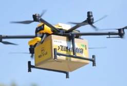
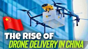
Drone delivery in China
has moved beyond testing into large-scale, routine operations,
particularly in cities like Shenzhen, for food, express packages, and
medical supplies. Leveraging a robust
low-altitude economy,
companies like Meituan, SF Express, and JD.com use drones to cut
delivery times by up to two hours in remote areas or, in urban centers,
to deliver within 20–30 minutes, with over 600,000 flights completed in
2024 alone.
KEY ASPECTS OF DRONE DELIVERY IN CHINA
-
Urban Operations:
In Shenzhen, Meituan utilizes a hub-and-spoke model where drones
transport food, drinks, and daily necessities to specialized pick-up
kiosks in parks or near residential areas. This system, which saw
over 100,000 deliveries in 2022, serves as a model for future
retail, with Meituan's robots also managing short-distance
deliveries.
-
Logistics & E-commerce:
SF Express (via Phoenix Wings) has completed over a million
deliveries, integrating cargo drones for express logistics. JD.com
focuses on rural areas, providing services to remote villages and
mountainous regions.
-
Medical & Urgent Deliveries:
Drones are used for rapid delivery of medical samples, such as tests
from hospitals to centers in just 6 minutes (cutting 20-minute
commutes). They are also used for high-value, time-sensitive items
like university admission letters.
-
Infrastructure & Policy:
The "low-altitude economy" is prioritized for 2026-30, with cities
like Guangzhou planning a 150-billion-yuan industry by 2027.
Operations are supported by widespread, specialized drone loading
areas and automated packaging systems.
-
Operational Scale:
As of 2024, Shenzhen has launched 94 new cargo routes, surpassing
200 total, and is a major hub for this technology.
The technology is
rapidly expanding to make delivery more efficient, reducing costs, and
navigating urban density or challenging terrain.
MILITARY DRONES
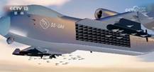 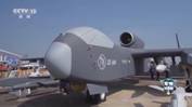  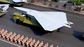 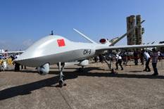
China's most powerful
military drones, primarily focused on high-endurance, stealth, and
massive AI-driven swarm capabilities, include the
Jiutian
(Joten) drone mothership,
GJ-X (WZ-7)
stealth UAV,
CH-7 Rainbow,
Wing
Loong X, and
Wing Loong II.
These systems emphasize long-range reconnaissance, anti-ship
capabilities, and autonomous swarm attacks.
-
Jiutian (Joten) Drone
Mothership: A
16-tonne, jet-powered, high-endurance drone capable of carrying up
to 6 tons of equipment, including smaller swarming drones for
coordinated attacks.
-
Guian
(Drone Mothership): A 25-meter wingspan, fully autonomous drone
acting as an "airborne air base" to release smaller, kamikaze drones
and jam enemy radars.
-
GJ-X/WZ-7:
A large, stealthy, high-altitude long-endurance (HALE) UAV, with a
wingspan of over 130 feet, designed for deep penetration and
surveillance.
-
Wing Loong
X (WL-X): Built for maritime
warfare, it can stay aloft for up to 40 hours, hunting submarines
with torpedoes and anti-ship missiles.
-
CH-5
Rainbow: A long-endurance, high-payload drone capable of flying
for over 60 hours, with a payload of 1,000 kg and the ability to
carry 16 missiles.
-
CH-7
Stealth: Designed for high-speed, stealth reconnaissance, and
mission planning.
-
Wing Loong II:
A versatile, heavily exported strike drone with a 32-hour endurance
and capacity for 12 air-to-ground missiles.
These systems represent
a rapid shift toward autonomous warfare, with the Jiutian and Guian
platforms designed to operate as "motherships" that can overwhelm
defenses without risking manned aircraft.
Jiutian (Joten) drone,
which can carry and deploy up to 100 smaller, AI-guided drones:
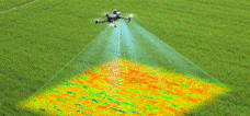
Remote sensing drones
for agriculture are specialized unmanned aerial vehicles (UAVs) equipped
with advanced sensors—such as multispectral, thermal, or high-resolution
RGB cameras—to monitor crop health, soil conditions, and field
management. These drones enable precise data collection for optimizing
water usage, fertilizer application, and pest control.
KEY TYPES OF AGRICULTURAL REMOTE SENSING
DRONES
-
Multispectral Drones (e.g., DJI
Mavic 3 Multispectral):
Equipped with sensors to capture invisible light wavelengths
(near-infrared, red edge) to analyze crop chlorophyll levels, plant
stress, and vegetation indices (NDVI).
-
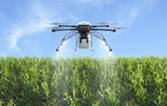
Spraying/Spreading Drones
(e.g., DJI Agras T50, T25):
These larger, industrial drones are used for precise, autonomous
spraying of fertilizers, herbicides, and pesticides, covering large
areas rapidly.
-
Fixed-Wing Drones:
Preferred for surveying very large areas efficiently due to their
long flight endurance.
Key Data Captured by
Remote Sensing:
Drones provide
high-resolution images that, when processed, reveal:
-
Crop Health (NDVI):
Identifies plant stress before it is visible to the human eye.
-
Soil Moisture Content:
Maps dry or saturated areas to optimize irrigation.
-
Plant Density and Count:
Assesses emergence and growth stages.
-
3D Terrain Mapping:
Uses overlapping images for volumetric analysis.
KEY DRONE INDUSTRY PLAYERS
Major drone
manufacturers in China dominate the global market, with Shenzhen-based
DJI leading with
over 70% of the consumer/civilian market. Other key players include
EHang
(autonomous aerial vehicles),
XAG
(agricultural drones),
Autel
Robotics,
and
JOUAV
(industrial UAVs). These companies focus on hardware, components, and
specialized services, holding a dominant position in the global UAV
industry
·
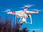
DJI (Da-Jiang Innovations):
Based in Shenzhen, DJI is the undisputed leader in consumer,
professional, and enterprise drones, known for the Mavic, Phantom, and
Inspire series.
·
EHang:
A leader in Autonomous Aerial Vehicles (AAVs) and Urban Air Mobility (UAM),
famously developing passenger-carrying eVTOL aircraft.
·
XAG:
Specializes in agricultural drones, robotic field equipment, and
autonomous farming solutions.
·
Autel Robotics:
Known for high-performance drones like the EVO series, competing with
DJI in the consumer and prosumer market.
·
JOUAV:
A major player in industrial UAVs, focusing on VTOL (Vertical Take-Off
and Landing) fixed-wing drones.
·
Yuneec:
Produces commercial and consumer drones, including the Typhoon and H520
series.
·
MMC (Micromulticopter):
Specializes in industrial, hydrogen-powered, and defense-related UAVs.
·
High Great:
A leader in drone formation shows and entertainment.
·
Xiaomi/Fimi:
Offers budget-friendly, consumer-grade drones.
·
AEE Technology:
Focuses on surveillance and industrial drone applications.
·
These
companies are heavily concentrated in Shenzhen and Guangdong Province,
which acts as a global hub for drone innovation, component
manufacturing, and research. |
